Maps are not simply a neutral rendering of the world but rather are shaped by the preoccupations of the mapmaker and the intended users. As such they can tell us much about what a society valued and how they viewed the world. We are used to seeing maps laid out like the Mercator or Peters projections, which are designed to represent latitude and longitude accurately to facilitate maritime travel. But in the Middle Ages, European maps were as much about telling stories about God’s creation as they were about facilitating travel. Conventionally, such mappae mundi were centered on Jerusalem and ordered the world by dividing it into the three continents known to them. The most common format is known as a “T-O map” because they depicted the earth as a circle divided into three portions divided by a T: Asia normally occupied the top half, with Africa and Europe in the lower right and left quadrants, divided by the Mediterranean Sea. The most elaborate of such maps provided more detail on various locations–known and fantastical–as well as illustrations intended to convey the religious significance of the image.
The map shown here is known as the Ebstorf Map, for the monastery where it was found in 1830. It was massive, made up of thirty vellum sheets covering a total of 12.75 square meters, and most likely the work of the English scholar Gervase of Tilbury, who was employed by the Guelph dynasty in Ebstorf. The map is focused on illustrating events from biblical tradition, for example Jesus’s resurrection in the center and the Garden of Eden at the top, as well as events from classical history like Alexander’s conquests. However, it also provides a record of important locations and their geographical relationship to one another, not so much spatially as in the order that one would meet them if traveling. For more details, see Henry Davis’s analysis or this interactive guide (auf deutsch).
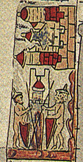
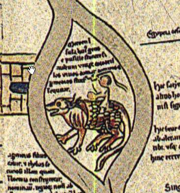
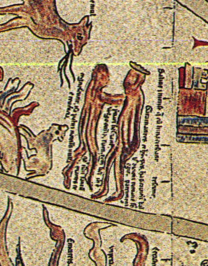
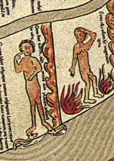
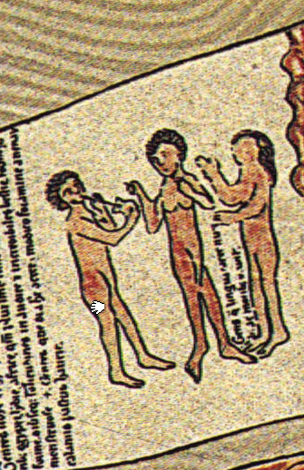
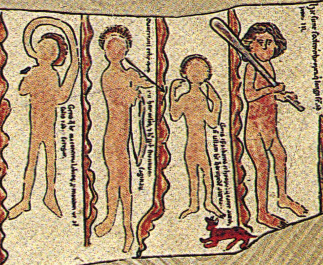
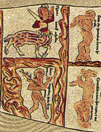
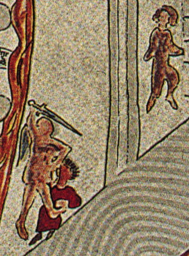
Africa stretches up the right side of the map, and it is depicted as a land of known locations and fantastical creatures. Animals described in more or less detail include apes, basilisks, camels, centaurs, crocodiles, dragons, elephants, hyenas, salamanders, satyrs, and a wide range of terrifying snakes. The map also details the many wonders of Egypt, including Thebes, identified as the home of Saint Maurice and his legion. It notes the wealth of the Christian kingdom of Nubia, a land of naked but respectable people who live by trade, as well as Meroë, where small people ride on crocodiles. The “Ethiopian Garamantes” are identified as a people who were conquered by the Romans, and among them children only know their mothers because all practice free love. In southern Africa one finds a wide range of wondrous people: deformed peoples who variously lack noses, mouths, tongues, ears; people who do not use fire; four-eyed people who are excellent archers; giants; speedy troglodytes; people immune to snake venom; people who fall over and others who walk on all fours; cannibals; people with the heads of dogs; and people whose lips are so large they can pull them over their heads to provide shade from the sun. Interestingly, the Garamantes have mostly dark skin, and there are two other unidentified dusky figures, but otherwise the map depicts all of the human figures in Africa with light skin.
The images come from a reproduction, as the original was destroyed by bombing during the Second World War.
Jeff Bowersox
Deutsch

Source: Kolossos, Ebstorfer World Map (2007), composite of images drawn from the EbsKart project. Via Wikimedia Commons.

Imagining a world centered on Jerusalem (early 1200s) by Jeff Bowersox is licensed under a Creative Commons Attribution-ShareAlike 4.0 International License. Permissions beyond the scope of this license may be available at https://blackcentraleurope.com/who-we-are/.
